Rock Bay Creek: Why Daylighting?
All the water that will ever be is, right now. National Geographic Oct 1993
“ ... daylighting is the redirection of a stream into an above-ground channel...to revert it to a more natural state, for the purposes of runoff reduction, habitat creation for species in need of it, or for aesthetic purposes. Daylighting intends to revitalize the riparian environment for a stream which had been previously diverted into a culvert, pipe or drainage system.” Wikipedia, Daylighting (streams)
Around the world expanding cities buried their creeks and ran them into culverts below ground. This was seen as a health measure since waterways had become dumping grounds and carriers of disease. It seemed progressive and timely. The City of Victoria embraced this idea in the 1890s. As the settler population increased, culverting creeks made it easier to expand cities. Once hidden, it became natural to forget the streams were ever there, unless you happened to have a wet basement or rivulets of water coursing down your street.
Things change. In a time of global warming, we are more in need of clean healthy water than ever. With the industrialization of our wild lands, millions/billions of gallons of water used in hydraulic fracturing (fracking), for example, are made toxic and lost to us forever. The climate crisis has triggered storm water issues not seen before. Various ideas come to the fore as a way to soften the landscape and give water a place to go. Daylighting is one approach to these issues.
Without water there is no life, no life for hummingbirds and mayflies, coho and cutthroat, bears, deer raccoons, and mice, and us humans. If we do not remember our water, if we do not take care of it, there will be no place for life as we know it on this earth.
Rock Bay Creek Watershed

A watershed is defined as any surface area from which runoff resulting from rainfall or glacial melt is collected and drained through a common point. The land within a watershed contains a common set of streams and rivers that all drain into a single larger body of water, such as a larger river, a lake or an ocean. For example, the Fraser River watershed is an enormous watershed. Small watersheds are usually part of larger watersheds.
Watershed boundary overlay created by Dan Doherty

The Creek and its History
Rock Bay Creek rises in what is now Fernwood, runs through Quadra Hillside,
Burnside Gorge, and empties into Rock Bay. The creek also drains parts of
North Park and Oaklands. It runs below three parks – Alexander Park,
Blackwood Park, and War Street Commons, and a community garden all damp
and swampy under winter rains.
Before the arrival of settlers, Rock Bay Creek – what we call it since its indigenous name has been lost – was a coho stream that poured into Victoria's Upper Harbour. Its water would have been cold, kept chill by overhanging old growth forest. Its bottom would have been gravel. Its mouth might have supported sedges, eelgrass, and a tapestry of berry plants buzzed by mayflies and a twitter of small birds. In autumn, coho returning from their sojourn in the ocean could be seen leaping the falls just above the mouth of the creek. Eagles and bears would have hunted the coho, now in their red breeding colours as they returned from the ocean to the pools where they were born.
In 1843, the Hudson's Bay Company built a fur trading post in what is now downtown Victoria, the first permanent British settlement. Lekwungen people moved from their village at Cadboro Bay to set up camp around the mouth of the creek. Other First Nations came from farther north to camp there and trade with the newcomers at the fort. Early settlers named the falls after Roderick Finlayson, second in command at the fort. Later they blasted the rock and paved them over to form the steep section along lower Queens Street between Douglas and Government Streets.


In the 1890s, the creek was culverted from Harris Pond where it rose to where it continues to feed into the Gorge. From the 1860s to the 1950s, a coal gasification plant operated by Victoria Gas and BC Electric on the four acres around the mouth of the stream, made it one of the most toxic sites in Canada. BC Hydro and Transport Canada spent nearly $150 million cleaning up the site. 2016 marked the end of a 13-year remediation process of the 1.7 hectare site. 250,000 tonnes of contaminated soil were removed.
During the remediation, First Nations youth painted murals based on designs by Butch Dick and Darlene Gait on plywood put up along Government Street. Imagery of bald eagles, whales, and pristine forests were reminders of what used to be there. Esquimalt Chief Andy Thomas said the art represented “our relationship to the land, the water and the resources you see painted in the pictures. It tells the stories of our families who lived on this land. When you take care of the land, the land is going to look after you.” In 2016, the Esquimalt and Songhees Nations purchased the site with ambitions plans for the future.
In 2015, as part of the international green mapping movement, a small group created a map of Fernwood, Then and Now. An 1863 map of Victoria showed a creek that was all but forgotten. Thus the idea of daylighting that creek was born.
Rock Bay Creek Revival is now working to raise awareness of the stream and to bring it back in several places. Other daylighting projects in Victoria have similar aims. The City of Victoria stands behind these initiatives. Our awareness of the crucial place of water is changing. Our understanding of the complex interplay of natural forces and the web of life continues to grow. Might we make it possible for the coho to return? Might we bring back the falls? With good strong dreaming, who knows? Crazier things have happened.
See more about Fernwood history at Victoria Heritage Foundation.


DIY Creek Walk by Dan Doherty -
PDF download - print (3-fold & 2 sides) and stroll the route of the underground creek, solo or with a group of friends.

Here's another DIY walk by Dan Doherty, around the Rock Bay Creek watershed boundary.


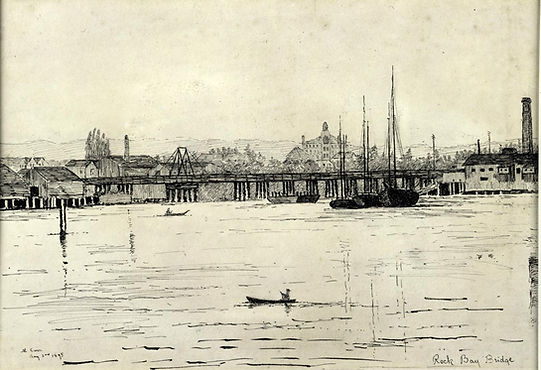
Drawing of Rock Bay bridge by Emily Carr 1895